Tuesday, June 26, 2012

Newfoundland

Today is June 18, day #13 of our trip and we are biking on "the Rock". There is a low cloud cover but that burns off after a while and we are in full sunshine. Lucy and I were in Newfoundland in 1971 for the first time and I remember this spot from that first trip. 

The sign in those days was warning for winds that could blow a train off the rails but since the train has been long gone, the sign had to be adapted. Hardly any wind today. I love this rugged landscape, it reminds me of Iceland. Not a tree in sight. Our target for today is the Wishingwell campground and according to the guide it opened on May 1 but once we reach it there is a steel cable across the entrance and not a soul in sight. In my book, cyclists are never turned away and we lift up the cable and make our way inside. Next we hang our hammock and go for a nap. My strategy is not to put up the tent right away until I get the feeling that things are going to be all right. In the meantime the owner shows up and as soon as I get out of the hammock he drives over in his pick-up truck and in a hostile way tells me to get lost. I explain that according to the guide he is open and that it is not that easy to pack up and go for the next campsite when travelling by bicycle. He does not give a darn and I have to go. The answer to my question of whatever happened to the Newfoundland hospitality is: "You just had a nap didn't you?" Now I would not stay even if he paid me and we pack up and find a spot near a stream about 2 km further down the road. If you ever go for a camping trip in Newfoundland, please don't stay at the Wishingwell  campground.


I am in daily contact with Lucy and she told me that she had a surprise visit from Eileen and Ted Hillier, friends we have known since our Churchill Falls days and have not seen for 18 years. They live in Bay
d'Espair in Newfoundland. They told Lucy that they are taking the night ferry that arrives in the morning of June 19 in Port aux Basques and would be on the lookout for me. Today is June 19 and day # 14 and I have calculated that they would pass me between 9:00 and 10:00am. At the end of a coffee break when I am ready to mount my bike a black SUV stops at the shoulder of the road and there they are! 

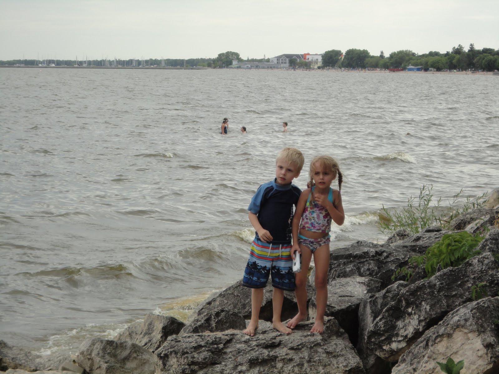
What a nice surprise and so good to see them again. Stupid me forgot to take a picture of this moment. They are on their way to their daughter Patty in Pasadena. I am invited to join them there since I will be near Pasadena tomorrow. It will mean that I have to do an additional 15 km tomorrow for a total of 88 km but I will do my best to be there. Our target for today is the Barachois Pond Provincial park but we reach it early and decide to keep on going. Soon we run into a moose fence and all vegetation between the fences has been stripped and no way to get off the highway to make camp or get to water. We are forced to keep going for another 25 km until the fence ends and now we can start looking for a spot.  


We are having great weather. No rain at all since June 10 and today is June 20, day #15. Just over 60 km to go to Pasadena, should be an early one. Slowly but for sure we have worked our way up to an elevation of 300m and near Corner Brook we get payback for our hard work and drop down over several kilometers to near sea level and enter the Humber River valley. There is a well know downhill ski resort here called Marble Mountain. There is a Tom Hortons at the foot of the mountain, the first one since Port aux Basques. Have to have a little break here!


We work our way through the coastal mountains through the Humber River Valley and soon cycle along beautiful Deer Lake. At around 10:30am we reach the "Welcome to Pasadena" sign and call Patty's house phone.


 Ted drives up to meet me and I follow him to the house where I meet Patty and Eileen. Patty grew up and has 3 daughters of her own now and the oldest is 20!  I am having a delightful time in their company and the day goes by far too quick. There is so much to talk about. Eileen makes Lasagna for supper and we are having a few glasses of Ted's home made wine. Don't have to make camp tonight, I can sleep on the couch in the rec room.

It is like sleeping in for me the morning of June 21, day # 15. At 7:30am I hear some noises upstairs and I get up myself. I am served a hearty Newfoundland breakfast and we say our farewells around 9:30am but not after promising to visit Eileen and Ted in Bay d' Espair in the near future.


At the town of Deer Lake we leave the Trans Canada highway and start travelling highway 430 up the North Western peninsula. Plan is to follow this highway all the way up to the end for 490 km one way. After we reach the end, we will have to come back the same way. If we are offered a ride part of the way on the way back, we won't decline. Cycling this route once is enough! We make camp at a shores of a small lake (or pond as they call it in NFLD).  


On June 22, day # 17 we have to work our way through the Long Range Mountains to get back to the coast. We do a lot of climbing and are soon  rewarded with a fabulous view. Good spot to have a coffee break. While there a delivery van stops and the driver informs me that a black bear crossed the road a little further down the road. A rare occurence in NFLD according to him. I thank him for taking the time to warn me. A bit later I spot evidence of a bear's presence, a garbage can with the lit removed and all garbage draped around it.


We now enter the Gros Morne National Park. Lucy and I were here exactly 40 years ago, highway 430 was a gravel road at that time and the park had just been created and was under development.
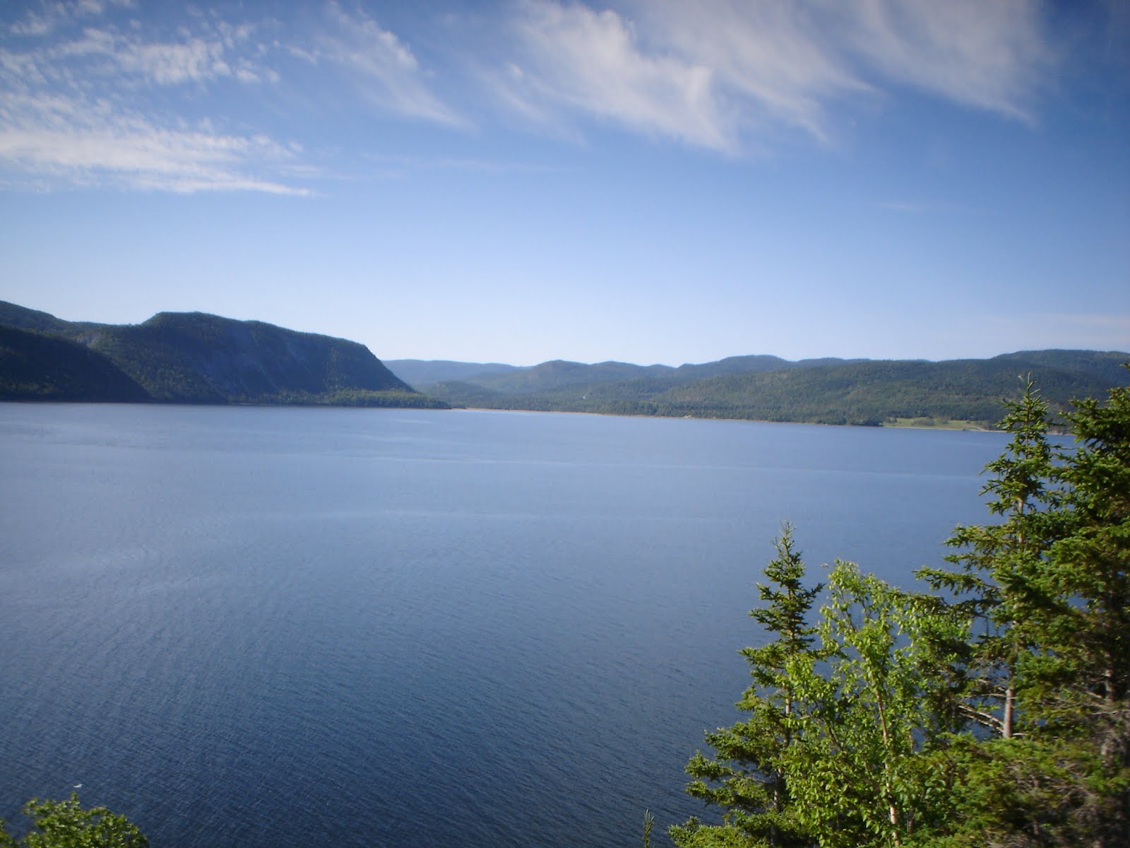
Now we are in for a real climb. Once we reach the top, my GPS indicates 332m, the highest elevation so far this trip. After descending, the road hugs the the east arm of Bonne Bay, a real fjord. At one time while cycling I hear a big "puffff" and spot a minky whale. He surfaces several times.


We are getting close to the Gulf of St. Lawrence. I can see fog trying to get into the fjord but the cliffs are holding it back.


We start to see the beauty of the park. There is an actual mountain called Gros Morne. It is the one with the flat rocky top in the picture.There is a hiking trail to this mountain.
After 44 km, well short of the planned 78 km, I call it quits and check in at a private campground in Rockey Harbour. I treat myself to a meal of pan fried cod at the local restaurant but 
it was not as good as the cod in Port aux Basques.


The next day June 23, Day # 18 it is foggy and we can't see the Long Range Mountains. During one of my stops a hare hops in my direction. Instead of running away he is getting closer. Are we under a hare attack? No, he goes around us and disappears in the high grass.


Many viewpoints along the way and we stop at all of them. Here is what is left of the SS Ethie. She ran aground on Dec 11, 1911 and all 92 passengers and crew survived the ordeal.


One of the must sees of the park is the West Brook Pond. This is the land-locked fjord you see on all the promo's of  NFLD and Labrador tourism. It takes a one hour hike to get to a dock where one can take a boat tour of the fjord. The boat tour starts at 1.00pm and needs at least 20 passengers to make it worth their while. Don't want to leave my bike and Bob unattended at the head of the trail. Have to make camp first. Since I am in a National Park, wild camping is not an option and I have to go for the nearest campground.


By the time I reach the Shallow Bay campground I am 23 km past the head of the trail. Decide to stay put for today on the campground and bike back to West Brook Pond tomorrow. Later in the day the fog lifts and we are in full sunshine again. The campground is a part of the National Park and has no serviced sites. But to my surprise it has WiFi available at the shelter/washroom building. The campground is right at the Bay of St Lawrence and has dunes and a sandy beach. My only complaint is that the place is infested with musquitoes.

June 24, day # 19 is another sunshiny day and a great day to visit the Western Brook Pond. By 10am we are on the road and can see the entry of the fjord from quite a distance. We missed it yesterday due to the fog. I am biking with no load, Bob has to stay at the campground. It takes just over one hour to reach the trail head and hide my bike in the bushes and mark the spot on my GPS. I reach the dock at around 11.30 and there is nobody there. 


Across the lake I spot a moose and her calf in the water. You will have to blow up the picture to be able to see them.


I have some time before the start of the boat tour and hike a side trail to the Western Brook and the fjord is always in view. Also use my filter to fill my water bottle from the brook.
By the time I get back to the dock it is 12:45 and I am in for a shock. There are at least 150 people waiting. Will there be room left for me? Yes, fee is $60 and you have to have a park permit. I had purchased a season permit at the visitors center a few days ago. Early bird special for $20.85. Normal fee is $45 for a senior. Enjoying Canada's natural wonders does not come cheap!

The boat tour takes about 2 hours and takes you to right to the start of the fjord. The length of the fjord is about 13 km. Once this fjord was connected with the Bay of St Lawrence but after the glaciers melted the coastal flatland re-bounced and the fjord became land locked. It is now a fresh water lake and the water is as pure as you can get and is 150m deep at places. High cliffs at both sides and several waterfalls spilling from them.
After this fun filled afternoon we still have to bike 23 km back to the campground. On the way back we stop at the town Cows Head and stop at the local restaurant. Guess what! Cod is on special! By the time we get back to our tent it is 8pm.

This nice weather had to come to an end. Today is Monday June 25, Day # 20 and showers started early this morning and lasted most of the morning. Long term outlook does not look good this moment.Taking a rest day today and use it to do some maintenance and to update the blog. Can do this blog work thanks to my notebook that I purchased a year ago in Whitehorse. I am 3 days behind schedule now but that is OK. Will make up somehow by shortening the trip. We have biked 1200 km since leaving home on June 6. All is well.

Monday, June 18, 2012

Nova Scotia and Prince Edward Island


Me and Bob are on another adventure. There are two provinces left on the bucket list, Prince Edward Island (PEI) and Newfoundland (NFLD). In the process we will also cover a good part of Nova Scotia (NS) by bike.

We left home on June 6 under grey skies and cool temperatures. This is the fourth time that we bike the route from home to the New Brunswick border so no surprises here. The first night we camped wild at the Mastodon Ridge near Stewiacke.  While eating a simple meal at the Chinese a light rain started, forcing us to make camp in the wet.

The rain stopped sometime during the night but the next morning the sky was just as grey. The target for day #2 was the Railway Station Inn in Tatamagouche where I met Lucy. This Inn is one of our favourites and our room was located in an original railway caboose converted into a hotel room.  We enjoyed a few beers at the local tavern and a good feed of panfried haddock. Later in the afternoon the sun came out and I was able to dry my tent.

Target for day #3 was the Amherst Shore provincial park but when Bob and I got there the park had not opened for the season yet. Makes you wonder why we have provincial parks at all if they are still closed on June 8. We pushed on to Port Elgin just inside New Brunswick, adding 30km to today's trip, where we made camp in the center of town on a grassy field near the harbour. We selected Port Elgin because there is a small diner there but unfortunately that one was closed as well. Without facilities to clean our pots we selected to eat chili straight out of the can after warming it up in the sun for a while. To make up for this inconvenience we treated ourselves to a can of "Canadian" from the liquor outlet across the street.

On day #4 we had to cross the Conferation Bridge that connects PEI with the mainland. This bridge is 13KM long and bicycles are not allowed to cross this bridge. There is a shuttle service for pedestrians and bicycles. The shuttle is not on a schedule, it goes on demand. When arriving at the foot of the bridge the shuttle happened to be right there to bring a load of golfers to the island. When I told the driver that I needed 15 minutes to take the side bags off my bike and to unhook the trailer he decided to come back for me later. While waiting for the shuttle to arrive it started to spit  and we arrived in PEI in the rain. From tourist information we got a lead on a simple motel just down the road and we stayed the night in the Carlton Motel in Borden.


Next morning on day #5 we picked up the Confederation trail near the motel. This trail is a former railroad bed converted into a multy purpose trail and it goes all across the island. The advantage is that one does not have to deal with other traffic and the grade is never over 1%. The disadvantage when I was travelling the trail was that the surface was soft due to yesterday's rain, giving the impression that one is biking on very soft tires. Also the wet reddish PEI dirt is picked up by the tires, spilling it all over my side bags and trailer. It is another grey day with drizzle off and on but that does not spoil the views of the beautiful PEI countryside. At one time we spot a fox at the side of the trail. The plan was to follow the trail until Hunter River but at the small town of Fredericton we changed to the hard surface of the main highway #2. We soon find out that PEI has some very steep hills as well. The target for today is the Vigeant Residence in Cove Head, about 55KM from the motel. We have been friends with Rosemary and Robert Vigeant since our Churchill Falls days and Leanne just started walking when we first met them. Leanne is now 35. Lucy arrived at the Vigeants the day we left the Railway Station Inn and is waiting for me. I had an early start this morning and will be arriving early. With 10KM to go I called Lucy to expect me around 12am. With about 5KM to go I met another bicyclist going the opposite direction and at closer range I see that it is Rosemary. After I had called she got dressed quickly and jumped on her bike to meet me! What a nice surprise and together we cover the last stretch.

We have very nice visit with the Vigeants. I planned a rest day for day #6 and use that to clean my bike and side bags. We visited one of Rosemary's sisters and picked up her mother, who just turned 92, in Charlttetown. She will join us for supper at R&R.
Rosemary surprised me by announcing that she will join me for day #7 cycling the 85KM from Cove Head to Wood Island where I will take the ferry to Caribou in NS. Robert will pick her up from there by car. She is part of a bike group that almost daily cycles their neighbourhood and four members will join as as well for the first 25KM. We meet at 8am at the house of Sue and Bernard where John (76) and his brother Ewen (78) are waiting as well. I set the pace since I have about 35KG hanging from my bike and will be the slowest. Shortly after 8am the group of 6 is on their way. When we reach Mount Stewart, the turn-around point for four of the group, my front derailler acts up. Looks like the bracket that holds it to the frame became loose and it turned. After this is fixed we say goodbye to our friends and Rosemary, Bob and myself head for the hills. Not an easy route that I selected. Quite a few long steep hills and a head-on wind all the way.

But Rosemary is quite the trooper, took all those hills without complaining and had no trouble at all keeping up with me. She really enjoyed my Crazy Creek chair when taking a rest. Weather was great, full sunshine all the way and warm. It took us a little longer than expected to cover the 85KM and we reached Wood Island at 4:30pm, just when the ferry was leaving. When we drove up to the terminal Robert arrived as well. Perfect timing! Rosemary's bike was tied to the bike rack and we said our goodbye's. The next ferry leaves at 8:00pm and it will be almost dark by the time we get to the other end. I select to stay in Wood Island to take next day's ferry of 6:30am and make camp on a grassy field near the terminal.

Not a good night sleep. Trucks rolling in all night to line up for the early morning crossing and most of them leave their engines idling. Boarding the ferry was uneventful and we are back in NS by 8:00am. Had a meal of bacon and eggs on the ferry. Target for day #8 is Arisaig Point on the Sunrise Trail. Weather is good again but once more I have a headwind. Just 5KM short of our target we run into the Red Roof B&B at McArras Brook. The sign reads "Vacancy" and the place looks very inviting. I learn that the home is modern and solar powered and is two years old. I am greeted by several barking dogs and the Inn keeper ensures me that they are friendly and that he was expecting me. After my reaction of surprise he realizes that I dropped in unexpected and there is another couple of cyclists on the way. No problem, they have a room for me.  I take a quick shower to wash all the sunscreen off me and I am presented with a complimentary beer. That is a first for NS! I can also sign up for dinner with complimentary wine for $15. I don't have to think long over this one! A short time later a Dutch couple arrives with real Dutch looking bikes. They flew in with Iceland Air and only paid 39 euro to ship their bikes. They started in Truro and are following the Sunrise trail and are also planning to bike the Cabbot Trail. Going to bed early. Breakfast will be at 7am, the earliest the Inn keeper was willing to go.  The Dutch couple will have their breakfast at 8:30am, far too late for me!

On the road by 7:30am on day #9. It is now Thursday June 14. Today we plan to bike to the Hyclass Ocean Campground. Lucy and I have been there before and have good memories. The weather could not be any better. Sunny and warm but once again I have a headwind. We arrive in the early afternoon and relax the rest of the day. Macaroni and a can of salmon for dinner.

Another nice day on day #10. Today we will cross the Canso Causeway that separates Cape Breton from the mainland. Only 22km from where I start today. To my surprise I find that the causeway has a good paved shoulder. Only the bridge crossing the lock is a bit tricky. I have to swing into the traffic lanes but there is no traffic at that moment. Short stop in Port Hawksbury for a breakfast sandwich at Tims and from there we follow the old trunk road #4 to St. Peters. We find the Battery Provincial park at the channel that connects the Bras d'Or Lake with the Atlantic Ocean. We make camp at a great spot overlooking a big inlet.

Mostly cloudy the next day #11. A fierce headwind develops shortly after we start and that combined with lots of steep inclines makes for the toughest day so far. The wind is no surprise, we are right at the shore of the Bras d'Or Lake. After 86KM of this we reach Sydney River where we pay a quick visit to the Superstore to bring up our supplies and have a quick bite to eat at McDonalds. Using their WiFi and internet I find a small motel just down the road but once we get there there is a small sign in the door "no vacancy". Find that hard to believe since there is not one car to be seen at the rooms. We are forced to go on for another 8KM to North Sydney where we get a room at the Highliner Motel. This made for a long day but we are less than 10KM from ferry terminal to NFLD.

We can take our time on day #12. The ferry departure time is 11:30am. When I reach the ticket booth I am asked if I have a reservation. No. Next I am told that the 11:30 is full and I can be booked on the next one leaving at 5:30pm. My insistence that there must be room for one person and a bicycle pays off. After a phone call I am OKed for the 11:30 sailing. Around 11:00 we board the MV Highlanders, a modern vessel that loads at 2 levels simultaniously. I make use of the time on board to work on my blog. The crossing takes about 6 hours and the Cabbot Straight is very calm. We reach Port aux Basques at 6:30pm (we are now on NFLD time, 30 minutes ahead of Atlantic time). By the time we are on the road again it is past 7:00pm and we check into the first hotel we see. Not surprisingly it is called Hotel Port aux Basques. To celebrate fathers day we have a beer and panfried cod at the restaurant. The cod was delicious. And now some more work to bring the blog up to date and that is it for today!

Sunday, August 14, 2011

Winnipeg & the trip home

Thursday July 28

“The Canadian" arrives in Winnipeg around 10:00pm,  2 hours behind schedule and  for the first time this trip we bike in the dark. It is 10:30pm by the time we arrive at the Sigurdsons house. Leanne, Jack and Lucy are waiting outside to greet me.


De rest of the family Leif, Eric and Kate are in Gimli and we will see them tomorrow.
Leanne has ordered a nice meal of sushi for a late evening meal.

Friday July 29

The Frost family arrives around 9:30am and all of us head for Gimli to the Sigurdsons cottage on the shore of Lake Winnipeg. It is there that we have the whole clan together for the first time.
The weather is great, the cousins play a lot on the beach and in the water and the adults have a lots of fun with Leif's newly acquired Sea-Do and with his Hoby craft (kayak with sail).


Saturday July 30

This weekend the Icelandic community in Gimli celebrates the Icelandic Independence from Denmark. There is a fair in town and a good display of fireworks in the evening that we watch from the beach at the cottage.


Sunday August 1

Before we know it it is Sunday afternoon and we drive to Winnipeg where we spend the last evening together at the Sigurdsons house.


Monday August 2

Suzanne, Matt and Julia leave early Monday morning for Toronto.
Lucy and I are staying for another week and we are fortunate to enjoy another weekend in Gimli with Leanne, Leif and the kids.


Tuesday August 9

In the evening  Bob and I leave for the train station, a 3.5km bike ride where we board “the Canadian" for Toronto departing Winnipeg at 11:30pm.


Lucy flies back to Halifax the next day.

Friday August 12

We arrive at the Halifax station at 6pm and bike the last 17km of this trip to our house on Greenmount Drive where we arrive at 8pm.


Wednesday, July 27, 2011

Hudson's Hope to Prince George

Day 41, Wednesday July 20,  73.1km

It is sunny starting off. For the last week we have had to deal with a head wind and again today. Initially we follow the Peace River Valley until we cross the river and then highway 29 heads for another pass of 930m to connect with Chetwynd and the Pine River Valley. 


Fewer trucks on this part of the highway and the ones we see carry long sections of pipe destined for a pipe line that is under construction. During one of my breaks a truck parks right next to us and we chat with the driver. Don't we look tiny compared to that truck!


We reach the summit at 12:40pm and expect to pick up speed descending towards Chetwynd but a fierce headwind is slowing us down. Reaching Chetwynd there is lots of dust and sand blown around and by the time we reach the tourist information center I am eating sand. 
There is a RV park 15km further down highway 97 or we can go 2km in the opposite direction to the Westwind RV park. Bob and myself don't feel like fighting this headwind for another 15km and choose  for the Westwind RV park. As to be expected, this RV park is like another work camp for migrant workers.
The main street of Chetwynd is lined with wood sculptures.


Day 42, Thursday July 21,  64.3km

A bit of rain overnight to make sure we will pack a wet tent. By the time we are leaving the sun is peeking over the mountains. We are heading for the part of highway 97 that was closed a few weeks ago due to washouts. What we are traveling now has parts of the shoulder washed out but I guess that is minor compared to what lies ahead. At 8:30am we reach the area where major reconstruction is ongoing and the highway is reduced to one lane for a stretch of 8km. I am told by the flag person that I am not allowed to ride my bicycle on this stretch and will have to hitch a ride in the pilot truck.


There is a wait of about 30 min before the traffic that is lining up now can go through and that gives me lots of time to take the paniers off the bike and to unhook Bob. There are actually 2 pilot trucks, one in the front and another one at the end of the queue. We will be riding in the one at the end. 


Here is a picture I took from the pilot truck. One lane of the highway was washed out and had to be reconstructed starting from the river's edge.


Once past the construction area biking is very pleasant. The traffic moves in blocks with a half hour lull in between when I have the highway to myself. We are still biking alongside the Pine River.


At 1:30 we reach the Silver Sands lodge/cafe and RV park where I am told that there is no room but after they realize that I am tenting I am allowed to camp near a creek on the property at no charge. Shortly after the tent is up it starts raining and I move inside and doze off.  When supper time rolls around it is still raining and I head to the cafe for a mushroom burger from the limited menue. Unfortunately the meat is way overcooked.

Day 43, Friday July 22,  89km

It rained most of the night. It has changed to drizzle by the time I emerge from the tent. Once again we fold up a wet tent and everything we touch feels damp. Are we having fun yet?
Right after leaving Silver Sands we run into another construction zone. This is not as a result of  washouts, it is a planned re-alignment and repaving of highway 97 but what a mess it creates. We have to work our way through 12km of soaking wet gravel road and at one point the gravel is so coarse and loose that we have to walk, not an easy task with all the weight on the bike. After 1.5 hours of bike time we averaged less than 10km/hr, this is going to be another long day!


Past the construction zone we have time again to enjoy the scenery which is quite nice. High tree- covered mountains on both sides. We even see a few mountain streams with clear water and you don't see too many of those anymore with all the soil disturbing that is going on.


We are heading for our last mountain pass for this trip, the Pine Pass at 933m. We reach the summit at 9:30am and it is damp and cold. I have to dig up my gloves before we start the descent.


After the summit the skies are getting lighter and once we reach the Tudyah Lake provincial campground at 3:15pm the sun is  making an appearance once in a while. This is probably a nice park when the weather is good but everything is wet and puddles everywhere, cars have left big ruts in the grass and there are lots of mosquitoes.
First thing to do now is to hang our wet stuff out  to dry.

Day 44, Saturday July 23,  75.8km

Guess what! We folded a dry tent this morning. Cloudy skies this morning but it does not look like rain right away. Once again we have a headwind. I think that we have had a continuous headwind since we dropped down from Steamboat Mountain on July 10.
We are biking alongside McLeod Lake and it is long and narrow.


Just before we reach our destination we see some good examples of the pine beetle devastation.


We reach the Crooked River provincial campground at 2pm. This park must have better drainage, there are no puddles and for a change we are not bothered by mosquitoes. The sun makes an appearance in the afternoon. Most of the afternoon we relax in the hammock.

Day 45, Sunday July 24, 76km

The last day of our bike trip has arrived. This will be the last time getting up at 4am for a while. Every morning before getting out of the tent I flex the ankle joint on my right leg while massaging the area just above the right side of my knee. It is a bit painful but since I started doing this on July 12 my leg has been problem free.
Another cloudy morning and while making breakfast it starts raining. My plea must have been heard, it is only a few drops and no more.
Highway 97 is mostly at an elevation of around 700m and I expect it to drop down near Prince George. We do descend to an elevation of 600m in the Salmon river valley.


Once we pass the bridge across the Salmon River the highway keeps going up and once we reach the "Welcome to Prince George" sign we are up to 740m. It is another 12km to our destination from here. The highway now turns into a divided highway but they forgot to add a shoulder, traffic is passing us too close for comfort. It is not until we are close to the Nechako River bridge that the highway descends steeply and we get our free ride.


Shortly after the bridge we reach the last GPS waypoint of our trip and find our way to the Economy Inn where we stayed on June 1. We arrive there at 1pm. They have a room available with direct street access and I can store my bike inside.


It took 45 days and 2976km on the bike and 8km on the pilot truck to get from Valdez to Prince George.
Time to celebrate! Supper at Shooters and Sleemans Honeybrown is on tap. Life is good.